


Team CSIRO Data61 finished second in the DARPA Subterranean Challenge, a three-year competition that aimed to uncover revolutionary new approaches for how the military and civilian first responders can operate in complex underground settings. CSIRO Data61 used Velodyne Puck LITE™ lidar sensors to help its mobile ground robots and drones autonomously navigate subsurface networks in unpredictable conditions.
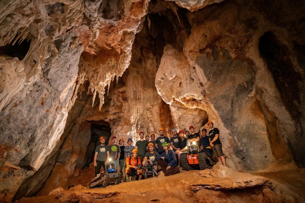
CSIRO Data61 was one of a small group of elite teams selected worldwide to participate in the three-year DARPA SubT Challenge, which concluded in a final event at the Louisville Mega Cavern in Kentucky Sept 21-24, 2021. Organizations on the CSIRO Data61 team included Velodyne’s customers CSIRO, Australia’s national science agency, and Emesent as well as Georgia Institute of Technology. It was the only Australian team in the competition.
The Mega Cavern event’s challenges were designed to simulate real-world scenarios and involve locating models representing lost or injured humans, backpacks or phones, as well as variable conditions such as pockets of gas.
DARPA challenges have a special place in Velodyne’s heritage. The catalyst for using lidar technology for autonomous solutions came to our founder David Hall while participating in the DARPA Grand Challenge for autonomous vehicles. David invented surround view lidar in 2005, helping to jump-start the autonomous revolution.
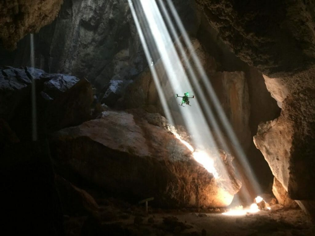
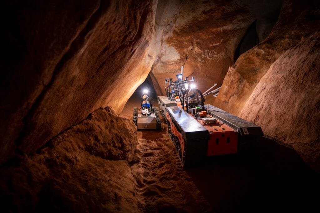
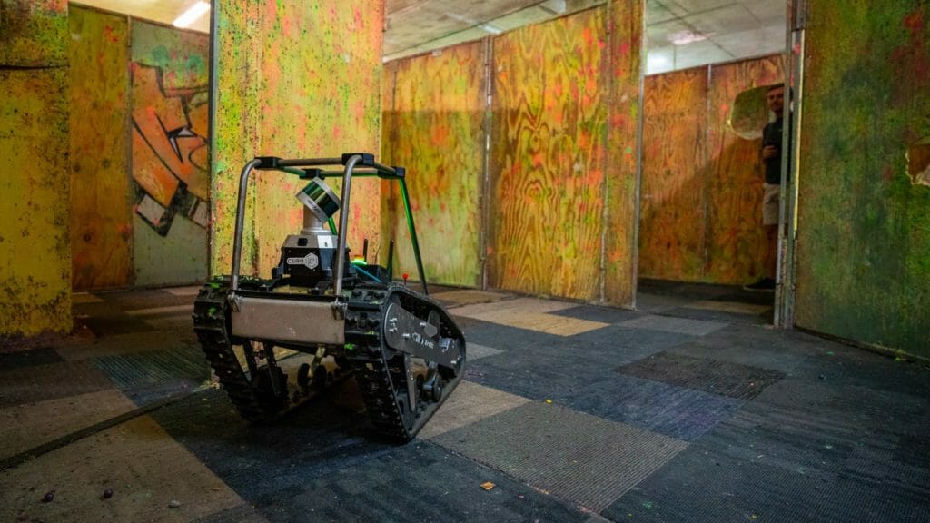
The CSIRO Data61 team’s robot fleet included two of Emesent’s Hovermap-enabled drones (“H1” and “H2”), two Boston Dynamics’ Spot quadruped robots (“Bluey” and “Bingo”) and two BIA5 all-terrain robot (ATR) unmanned ground vehicles (“Bear” and “Rat”).
Hovermap is a smart mobile scanning unit that uses Puck LITE sensors to map challenging, inaccessible areas such as caves. Spot is a mobile robot designed to automate sensing and inspection, capture data and explore without boundaries.
Similar to the Hovermap payload on the Emesent drones, each of the ground robots had a “CatPack” with a Velodyne lidar sensor running CSIRO’s Wildcat SLAM. This is what enabled the robots to explore without boundaries. All ground robot CatPacks had four cameras pointing at each direction – front back, left, right, allowing them to see in each direction. The Velodyne sensors provided 360-degree, surround view coverage for mapping.
Team CSIRO Data61’s competitive advantage was the concept of homogenous sensing on heterogenous platforms. All robots, including the Emesent drones, Boston Dynamics Spots and BIA5 Titans, had Wildcat SLAM running, fed in through Velodyne lidar sensors and the same communication system. Each of them also had the same visual object detection system running. The hardware on the drones had a different form factor than the ground robots but the SLAM and perception systems were the same. This allowed efficient teaming behaviors, with each robot sharing their map information and object detections with each other.
The team’s drones H1 and H2 can quickly create 3D maps. Hovermap uses lidar data and advanced algorithms onboard in real time to provide reliable and accurate localization and navigation without the need for GPS. The drones also operate beyond line-of-sight and communication range, with Emesent’s inbuilt collision detection and avoidance technology.
Bear and Rat, the team’s ATRs, have the ability to work in unknown environments, thanks to the sensor technology’s mapping abilities, and can be the eyes for first-responder teams when entering dangerous situations. These ATRs can also carry significant weight, enabling their marsupialing skills, the ability to transport other crucial robots to save battery life.
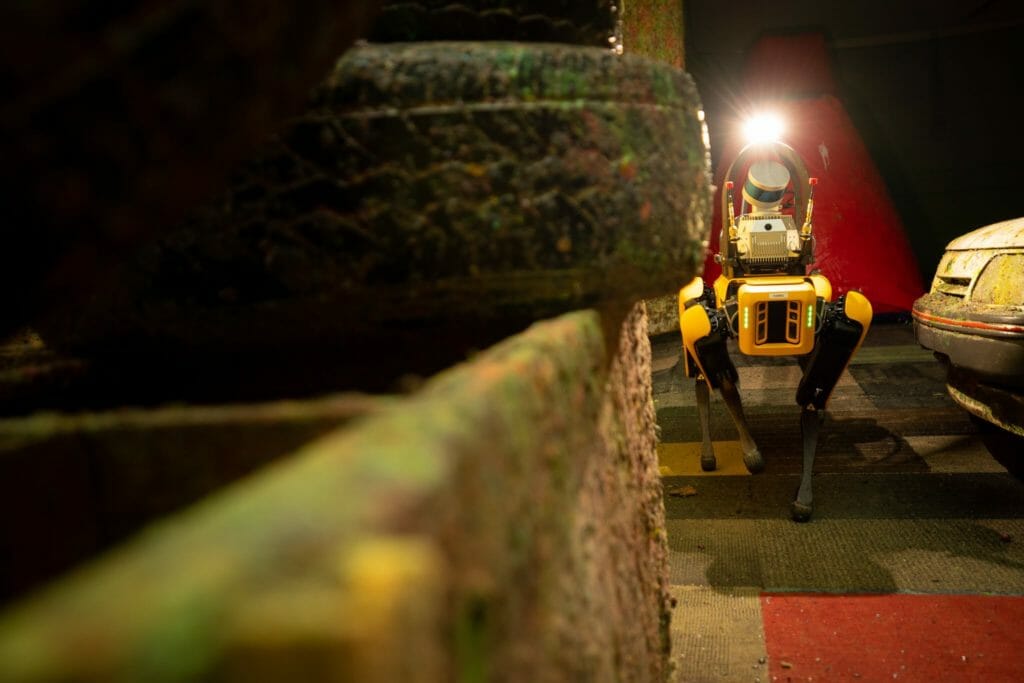
As with the ATRs and drones, Team CSIRO’s Bluey and Bingo were equipped with Velodyne lidar sensors to help them navigate. Bluey and Bingo could go where Bear and Robot could not. Thanks to their sensor suite, these dog-like robots even have eyes in the back of their heads, allowing them to survey in all directions.
The Velodyne lidar sensors delivered superior performance in smoke-filled and dusty environments compared to products used by other teams. DARPA filled sections of the course with smoke and CSIRO Data61’s combination of Velodyne lidar sensors and Wildcat SLAM, allowing the robots to manage these environments quite well and perform their tasks.
By combining the drones equipped with Hovermap, the ATRs and the quadruped robots, Team CSIRO was able to create a dream team for whatever DARPA threw its way, finishing second with a tied number score with the first-place team.
In discussing the challenge, Dr. Farid Kendoul, Emesent CTO and Co-Founder, said, “This is an incredible outcome and the result of many years of hard work and collaboration by our team. A big thank you to all the people who helped with this project. We’re so proud of the contributions that Emesent has made in the last three years to advance the state-of-the-art in robotics and showcase the capabilities of Australian companies on a global stage. Congratulations Cerberus (the challenge’s winner).”
Dr. Navinda Kottege, Team Leader of team CSIRO’s Data61 and CSIRO’s Robotics Group Leader, said, “This is an amazing result! We are the first Australian team to place in the top two at a DARPA robotics challenge. This cements CSIRO’s place as a world leader in robotics and puts Australia firmly on the map in this increasingly important area of science.”
Congratulations to Team CSIRO for this milestone and great achievement!

Velodyne Lidar (Nasdaq: VLDR, VLDRW) ushered in a new era of autonomous technology with the invention of real-time surround view lidar sensors. Velodyne, a global leader in lidar, is known for its broad portfolio of breakthrough lidar technologies. Velodyne’s revolutionary sensor and software solutions provide flexibility, quality and performance to meet the needs of a wide range of industries, including robotics, industrial, intelligent infrastructure, autonomous vehicles and advanced driver assistance systems (ADAS). Through continuous innovation, Velodyne strives to transform lives and communities by advancing safer mobility for all.


