Routescene, headquartered in Edinburgh, Scotland, designs, develops and manufactures integrated three-dimensional lidar mapping solutions for drones (Unmanned Aerial Vehicles or UAVs). The Routescene UAV lidar system is commonly used for hard to reach, hazardous and hostile environments. It is particularly well suited to applications where high penetration of dense vegetation is required.
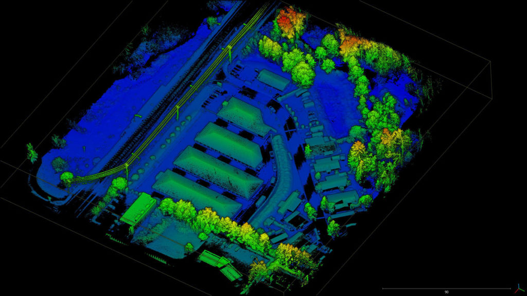
Routescene’s proprietary software, LidarViewer, offers a wide range of filters which dramatically reduce the time taken to post-process data. For example, application of the purpose-built ‘Bare Earth’ tool means Digital Terrain Models (DTMs) can be quickly and easily produced, removing all the non-ground points to reveal the surface below.
Because of these powerful capabilities, Routescene is seeing the increased use of its system for archaeology and forensics, discovering artefacts in thick vegetation and wooded areas that are not easily visible at ground level. Other applications include forestry, landslides, flood management and mining.
The challenge was to survey and visualize the site of a World War II SS prison camp and graveyard on Alderney in the Channel Islands. During the war, the island, a UK dependency located 10 miles from the coast of France, was occupied by the German army. A labour camp that housed over 4,000 prisoners was built and run on the island.
Caroline Sturdy Colls, Professor of Conflict Archaeology and Genocide Investigation at Staffordshire University in the UK, contacted Routescene’s customer Flythru to conduct the surveys and undertake the data analysis. The archaeology team used Royal Air Force (RAF) reconnaissance photos taken during the war and records from a German War Graves Commission investigation from 1960 to establish the location of the site.
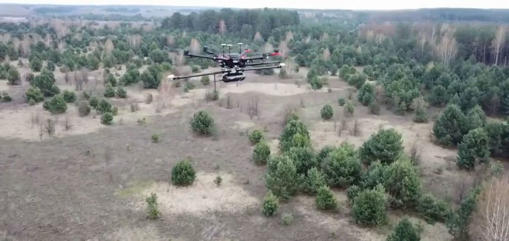
The area was covered in dense undergrowth, obstructing the remaining structures of the camp from view. UAV lidar was selected as the most appropriate survey method due to its high-resolution vegetation penetration capabilities which conventional survey methods are unable to do.
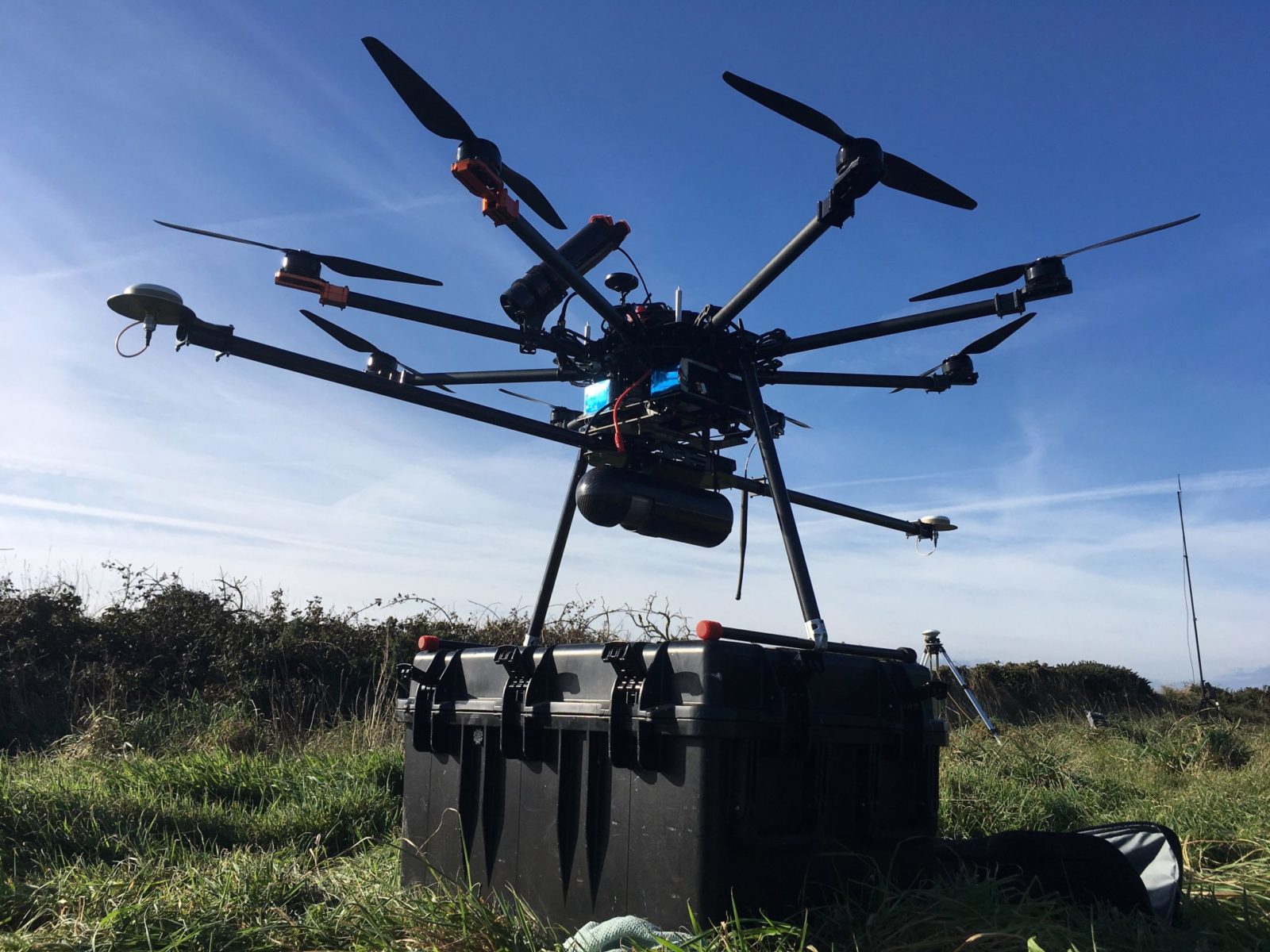
Routescene’s UAV lidar system, which includes the LidarPod and LidarViewer, was used. The LidarPod consists of a variety of carefully selected sensors including the Velodyne HDL-32 lidar scanner. With a scan rate of up to 1.4 million points per second collected by 32 lasers angled in a 40-degree field of view, the sensor enables a high-resolution point cloud to be created. The Flythru team was able to penetrate the dense vegetation covering the site to gather up to 400 points per square meter on the ground.
This unparalleled level of point density on the ground was the key to unlocking the findings on the site. Using Routescene’s LidarViewer software, the vegetation was digitally removed to expose the ground surface and create a detailed bare earth model, revealing undiscovered features that had been completely obscured by the vegetation.
Professor Sturdy Colls identified three new sites of interest and potentially a mass grave. By combining a number of techniques including lidar data, digital terrain modelling, along with photogrammetry, ground-penetrating radar and the WWII RAF photography, the team overlaid all the results to create a digital model of the prison camp.
The research was featured in a documentary ‘Adolf Island’ that has been shown on the Smithsonian Channel.
We are delighted to see the Routescene LidarPod and LidarViewer software being used in such important research. The system is a quick and effective way of surveying small sites covered in vegetation. Customers find it extremely useful to analyze and interpret the data on-site to inform further work whilst all the experts are on-hand.
The Velodyne HDL-32 provides the high resolution and accuracy needed to collect survey-grade data and is an integral part of the Routescene UAV lidar system. A proven product that has been in use all over the world for a number of years.
For over three years, we have been using the Routescene UAV lidar system. It has proved to be a valuable tool for applications where we need to penetrate vegetation. It would have taken weeks to survey and analyze the Alderney site without the lidar drone system and software and the results would have been vastly inferior. In a couple of 15-minute drone flights, we were able to gather all the data we required.
The lidar data assisted us greatly with our research. Due to the large size of the site and that it was so overgrown with vegetation, using lidar with a drone was the obvious choice. The results were better than we had expected. New structural elements of the camp were identified that were previously hidden by a thick cover of vegetation. For the first time we have a complete digital reconstruction of this important site.