


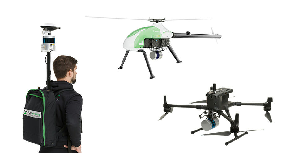
Based in Switzerland, Automated with Velodyne partner TOPODRONE designs and manufactures high-precision lidar equipment for installation on drones, vehicles and backpacks. TOPODRONE’s lidar solutions are used for mapping and 3D modeling as well as forest and agricultural monitoring. Their advanced post-processing software provides users with easy-to-use innovative data processing workflows for automatic data generation, georeferencing and alignment using GNSS and IMU data post processing, and SLAM algorithms.
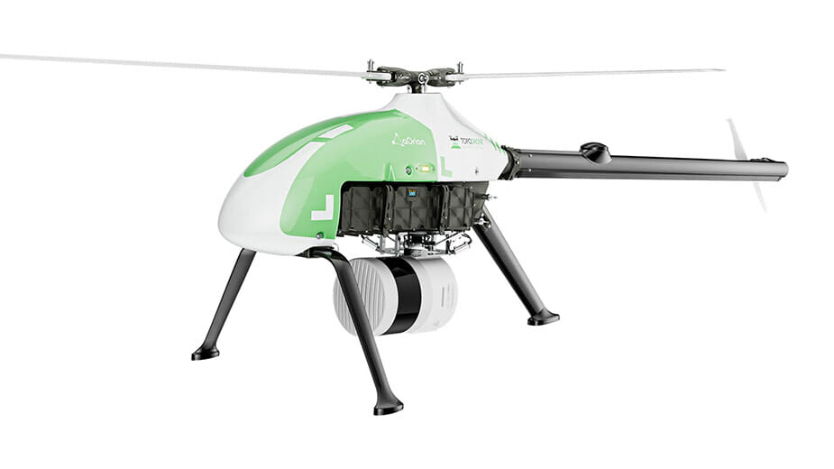
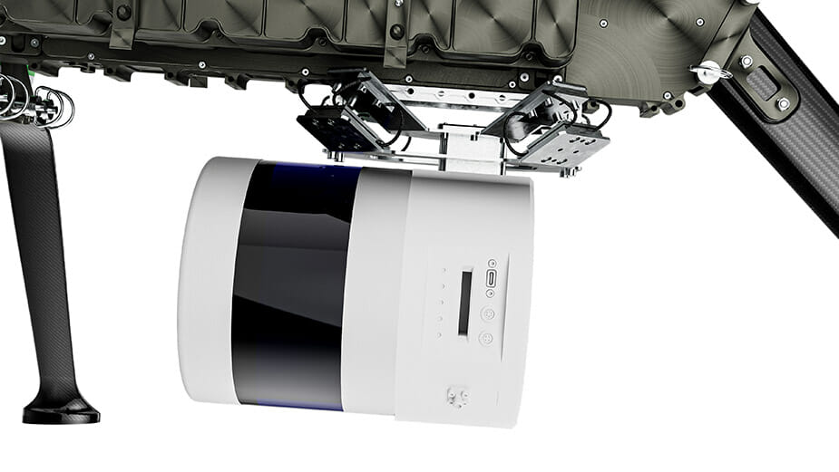
TOPODRONE has announced a new solution that fills the gap between heavyweight and expensive manned aerial lidar systems and lightweight drone lidar systems. Meet LiDAR PRIME + aOrion Heli-E! LiDAR PRIME is TOPODRONE’s most advanced lidar system, with a working range up to 300 meters covering a 500-meter corridor width and more than 20 km2 per flight with the aOrion helicopter. This new system is enabled by the Alpha Prime sensor, Velodyne’s world-class, long-range lidar sensor.
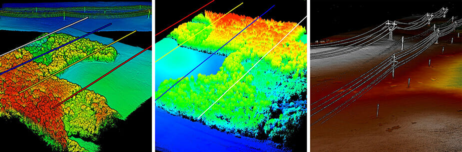
With LiDAR PRIME, mapping with lidar is better than ever. Users can dramatically expand their applications to survey large areas that were previously only possible to survey using manned airplanes or helicopters. LiDAR PRIME provides users the opportunity to captures tens of kilometers of power lines, dozens or even hundreds of square kilometers of a surveying area, and more.
TOPODRONE’s full payload range is built on Velodyne Lidar’s sensor technology, including the HDL-32E, Puck Hi-Res, Ultra Puck and Alpha Prime. Velodyne’s lidar sensors are installed on board unmanned helicopters together with TOPODRONE’s P24/P61 for survey and mapping, providing previously unavailable efficiency to the market.
Velodyne’s lidar provides TOPODRONE the outstanding quality, working range and capabilities for their mapping solutions. Their partnership with Velodyne has helped TOPODRONE to substantially increase their number of products for the surveying and mapping markets. TOPODRONE’s coming models based on Velodyne’s sensors can continue to help provide game-changing technology for the market over the next year.
Click here to learn more about TOPODRONE’s LiDAR PRIME + aOrion Heli-E.
To contact the Velodyne Sales team, please email [email protected].

Velodyne Lidar (Nasdaq: VLDR, VLDRW) ushered in a new era of autonomous technology with the invention of real-time surround view lidar sensors. Velodyne, a global leader in lidar, is known for its broad portfolio of breakthrough lidar technologies. Velodyne’s revolutionary sensor and software solutions provide flexibility, quality and performance to meet the needs of a wide range of industries, including robotics, industrial, intelligent infrastructure, autonomous vehicles and advanced driver assistance systems (ADAS). Through continuous innovation, Velodyne strives to transform lives and communities by advancing safer mobility for all.


