


High-precision 3D maps are an essential component behind services such as autonomous driving, robot delivery and smart cities. They enable self-driving vehicles and mobile robots to move safely, and they replicate the real-world environment of buildings, roadways and more needed in smart city applications.
MOBILTECH, a tech startup based in Korea, provides a 3D spatial information service that uses mapping, localization, perception and sensor fusion technologies. They offer a portfolio of 3D mapping scanners, which include Velodyne’s lidar sensors, that can be deployed in vehicle, handheld and unmanned aerial vehicle (UAV) mode. MOBILTECH has also developed a smart city solution including HD map, city digital twin and public facility management data.
To learn more about MOBILTECH, and how they are building core technology for smart city solutions, we reached out to Chang Hoon Kim.
Chang Hoon: As you well introduced our company in the intro, MOBILTECH is an AI-based 3D GIS startup. We are helping to launch a new type of mobility to your daily life by offering a 3D GIS (geographic information system) of the city environment.
Chang Hoon: We are trying to copy the real world in the form of a 3D map ASAP using AI technology. Unlike current services like Google Earth, this data is fully usable for new types of mobility.
Nowadays, smartphones use 2D maps on an everyday basis in various applications. If we look into the process of how a 2D map is made, it looks quite simple. Collect the data then look at it or draw it, depending on the data’s purpose. The process has been repeated and shortened using satellite-based images. Sometimes the result doesn’t really fit with the real world, but it’s ok to ignore that little clumsiness and safely find the way.
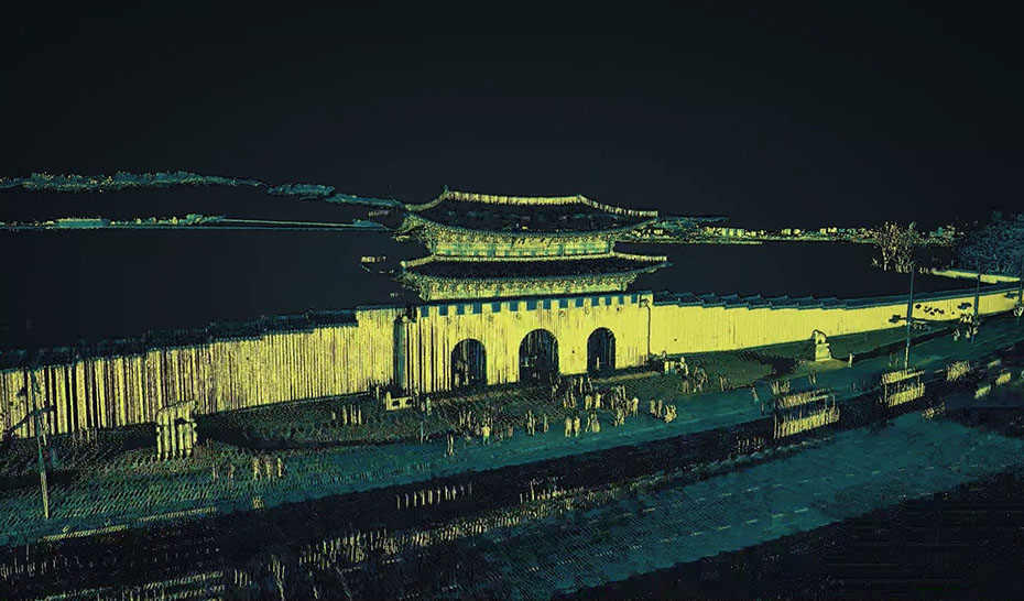
However, if a robot wants to find a way back home, tiny errors of the map could go poorly. Even if it’s ok to have some mistakes with 2D maps, when it comes to 3D map making the process is totally different. We need a lidar-based data collection system and technicians need to draw many more things in 3D. Even satellites don’t really do the work that’s needed.
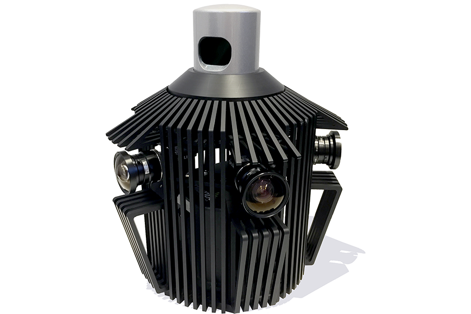
Chang Hoon: MOBILTECH loves using Velodyne lidar for survey purposes. To make an HD map it is essential to have robust performance for the road environment. Until now, the mapping accuracy of HDL-32 is the best in its class.
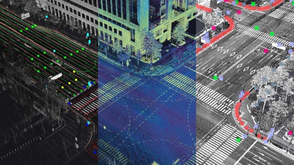
Chang Hoon: Replica City is a 3D city data subscription service. Basically, we set up a physical city data updating system to a designated area and offer it to various services. It includes three types of data: an HD map for AV (autonomous vehicles), a digital twin for city planning/construction, and a public facility database for city management.
Chang Hoon: With an HD map, you can launch the next generation of smart mobility services in your cities, such as self-driving shuttles, delivery robots or driverless trucks. We also provide a localization API developed and based on our HD maps.
A digital twin is replica data of real-world objects and environments, allowing you to check the functionality of a city. For example, you can analyze traffic volume, estimate road drainage or simulate the cityscape.
With our public facility database, you can maintain public utilities in their best status. A well-made public facility database makes it possible to manage public facilities easily from your office. You can get the status and location of the facilities in the office through surround-view images and coordinates from each facility. MOBILTECH AI software categorizes them to help you to find the data easily. The surround-view archive function will help you track the transformation of your facilities.

Velodyne Lidar (Nasdaq: VLDR, VLDRW) ushered in a new era of autonomous technology with the invention of real-time surround view lidar sensors. Velodyne, a global leader in lidar, is known for its broad portfolio of breakthrough lidar technologies. Velodyne’s revolutionary sensor and software solutions provide flexibility, quality and performance to meet the needs of a wide range of industries, including robotics, industrial, intelligent infrastructure, autonomous vehicles and advanced driver assistance systems (ADAS). Through continuous innovation, Velodyne strives to transform lives and communities by advancing safer mobility for all.


