


Geotech’s Lidaretto 3D mobile surveying system can go anywhere. The system is compact and lightweight in order to be deployed in multiple ways according to a specific application need, including a drone, car, boat and backpack.
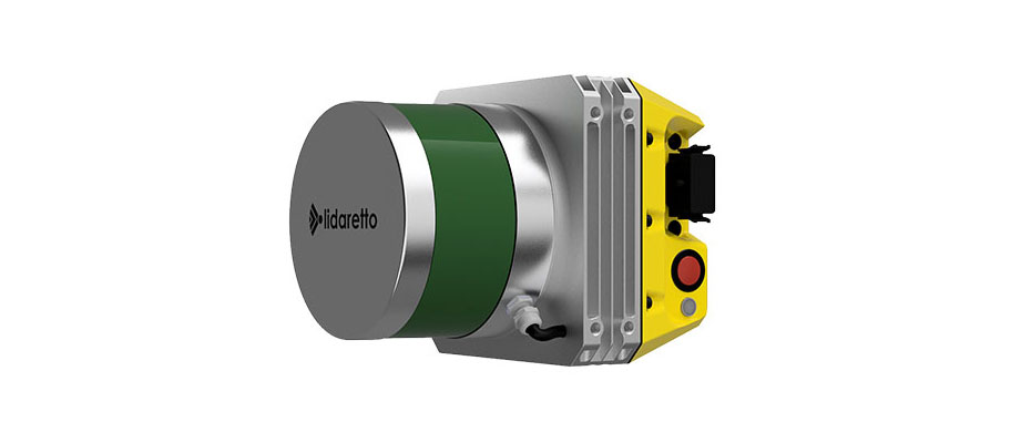
Lidaretto combines Velodyne Lidar Puck™ sensors and Novatel GNSS positioning technology, along with Geotech-developed algorithms, to produce highly-accurate point clouds for a variety of field applications. These mobile mapping areas include agriculture, construction, environmental assessment, forestry, mining, power transmission lines, and more.
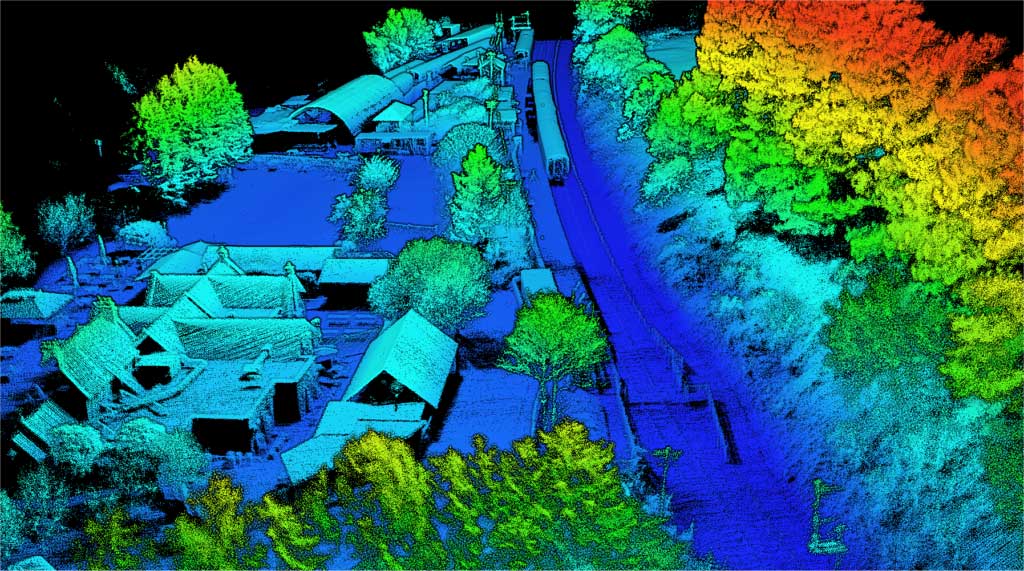
For instance, in road and railways construction, Lidaretto is an effective tool for continuous 3D mapping of the earth work progress to compute the volumes, surfaces, and topography. Another example is utilities can use Lidaretto for the inspection of power transmission lines, providing the outputs critical for securing uninterrupted distribution of electricity.
“We rely on technologies from worldwide leaders, such as Velodyne, to deliver the best possible geospatial data accuracy. The compact size and versatility of the Puck sensor enables customers to make one survey system investment that can cover multiple applications, saving themselves money,” said Erik Frohmann, director of sales at Geotech.
Lidaretto has been built to be easy to use. Geotech designed the system to make its workflow as simple as possible to allow a user to operate Lidaretto without previous skills with lidar mapping technology. It is a fully-autonomous system that includes positioning technology inside, so for drone deployments Lidaretto does not need to be integrated with any electronic system on the drone.
“We aim to produce quality products from quality components for reasonable and competitive pricing. With Lidaretto, we have been able to make lidar mapping technology available to the masses as a standard data capturing tool. Mobile mapping has never been so easy,” said Frohmann.

Velodyne Lidar (Nasdaq: VLDR, VLDRW) ushered in a new era of autonomous technology with the invention of real-time surround view lidar sensors. Velodyne, a global leader in lidar, is known for its broad portfolio of breakthrough lidar technologies. Velodyne’s revolutionary sensor and software solutions provide flexibility, quality and performance to meet the needs of a wide range of industries, including robotics, industrial, intelligent infrastructure, autonomous vehicles and advanced driver assistance systems (ADAS). Through continuous innovation, Velodyne strives to transform lives and communities by advancing safer mobility for all.


