


Lidar technology was developed in the early 1960s, closely following the invention of the laser in 1960. The American space program used lidar technology to map the moon’s surface during the Apollo 15 mission in 1971, giving the world just a taste of what lidar can do. Since then, lidar sensors have been deployed all over the world and the technology is changing people’s lives for the better. Lidar is now being used in many game-changing applications, such as autonomous vehicles (AV), robotics, delivery, smart cities, drones, mapping and more.
Lidar technology usage is exploding in popularity around the world. Take a look around you and you just may spot lidar in action. The first place you may see lidar in your everyday life is in consumer electronics. The latest versions of the Apple iPhone and iPad Pro include a lidar scanner and Apple, Ikea, Microsoft and others offer lidar-based apps. These apps can measure people and objects, let you virtually place true-to-scale models of furniture in your home, allow vision-impaired people to have more access to information around them and more.

Lidar technology is being deployed to conduct curb and parking analysis for on-street parking demands in an active city neighborhood in Pittsburgh as well as monitor overhead electric power lines to help prevent destructive wildfires. Lidar is also being used to improve transportation for people with disabilities, power agricultural tool carriers to increase farm efficiency in Europe and much more.
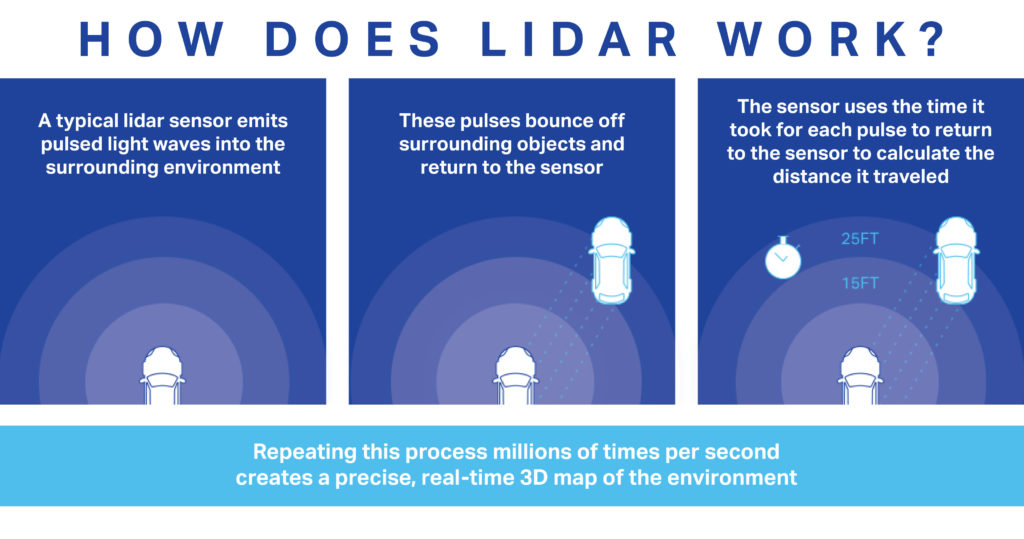
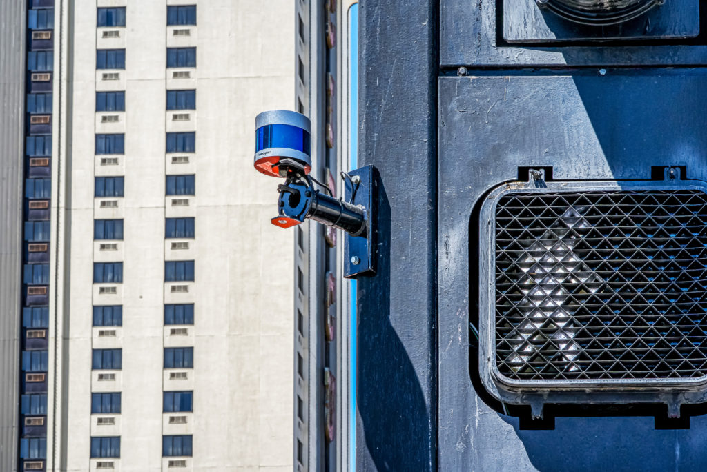
Lidar is an acronym for “light detection and ranging.” It uses eye-safe laser beams to create a high-resolution representation of a surveyed environment. Lidar “sees” the world in 3D, which is essential for machines and computers to accurately and precisely measure objects and movement.
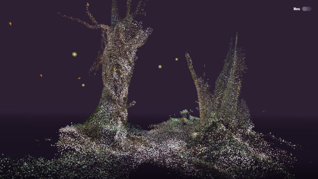
Lidar is sometimes called “laser scanning” or “3D scanning.” The technology uses laser beams to create a 3D representation of the surveyed environment. To break this down: lidar technology uses pulsed lasers to measure the distance to an object. The sensor bounces up to millions of laser pulses per second off surrounding objects. Based on the pulses’ time of flight, distance to the object is calculated in real time. Depending on the lidar sensor, tens of millions of data points can be generated to produce a point cloud, which is a 3D “map” of the surroundings.
Let’s take a closer look at a few of the many applications for lidar technology.
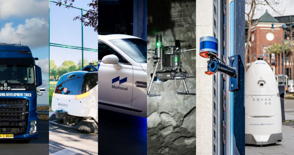
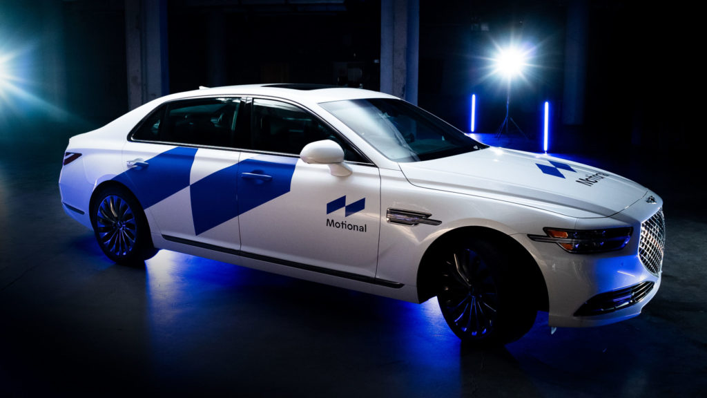
Lidar sensors can be considered an essential component in autonomous vehicles because they create a precise map of ever-changing surroundings for a moving vehicle to safely navigate. One example of an AV company using lidar is Motional, who has been at the forefront of driverless innovation. According to Motional, their vehicles power the world’s most established robotaxi fleet, a service that has safely conducted over 100,000 rides. They are using Velodyne’s Alpha Prime™ lidar sensors to provide long-range, surround view lidar capabilities in their SAE Level 4 driverless vehicles.
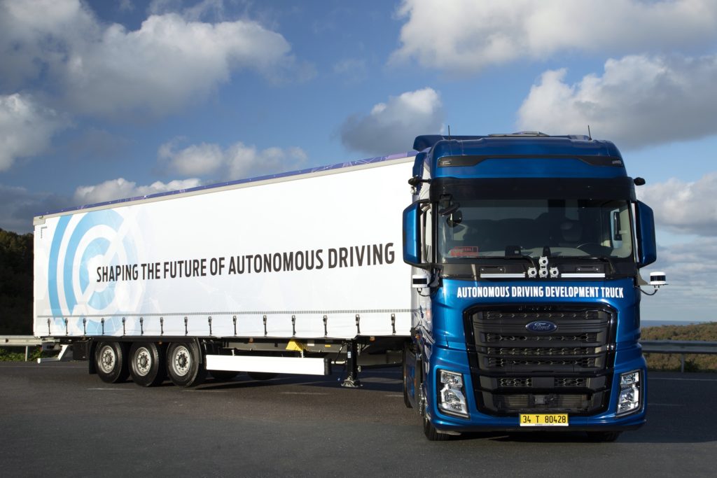
In trucking, Ford Otosan is collaborating with Velodyne on product development and testing of autonomous heavy commercial trucks. Ford Otosan currently uses Velodyne’s Alpha Prime sensors. They are also testing and planning to use Velodyne’s Velarray H800 lidar sensors for advanced driver assistance systems (ADAS) to enable safe navigation and collision avoidance in next-generation vehicles.
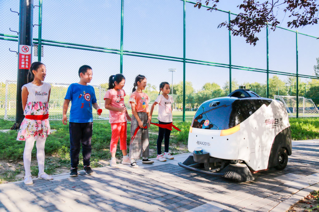
Lidar has emerged as playing a key role in robotic autonomy and navigation. Lidar sensors can enable mobile robots to move outside controlled situations and function safely in unfamiliar and unpredictable settings. Through point cloud data, lidar sensors are able to inform robots about their surroundings, including locating the position of objects and people.
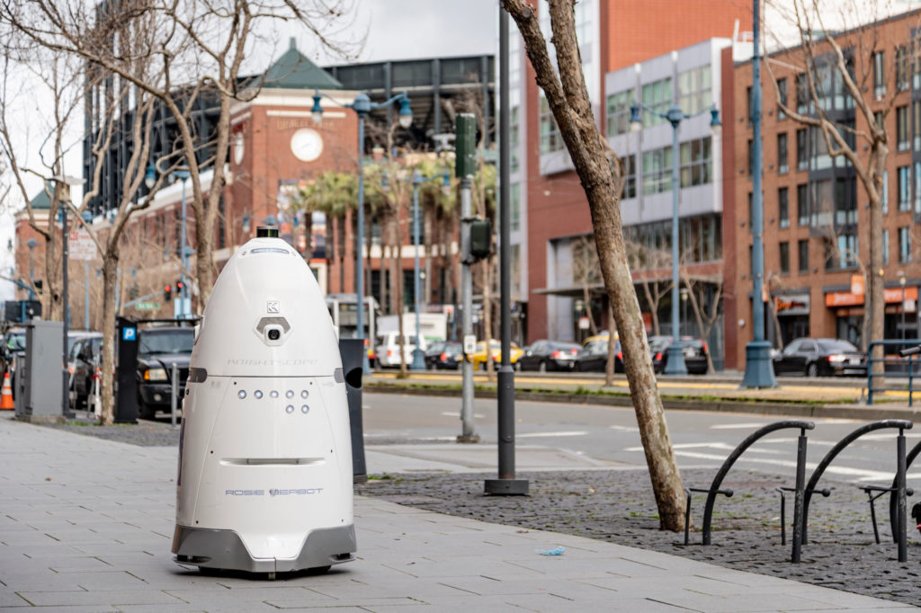
Autonomous mobile robots have provided crucial support during the COVID-19 crisis. They have automated tasks to reduce human exposure to contagions, allowing essential services to be performed, and advanced safety for frontline workers.
Construction is another industry where robotics are delivering benefits. Barcelona-based Scaled Robotics is using robots from Clearpath Robotics that are equipped with Velodyne Puck™ lidar sensors to track construction projects. The solution allows construction managers to closely monitor jobsite progress and identify problems before they become costly expenses.
Lidar enables advanced smart city applications to improve social welfare and operational efficiency. These systems use lidar sensors to measure and monitor conditions for pedestrian safety, vehicle traffic and parking space management, and more. With lidar, smart city applications can improve public services and enhance safety and quality of life.
For instance, the University of Nevada, Reno’s Nevada Center for Applied Research has deployed Velodyne’s Ultra Puck™ lidar sensors with traffic signals in real-world test environments in Reno and Henderson, Nevada. The intelligent traffic management system leverages data captured with lidar to help improve traffic analytics, congestion management and pedestrian safety.
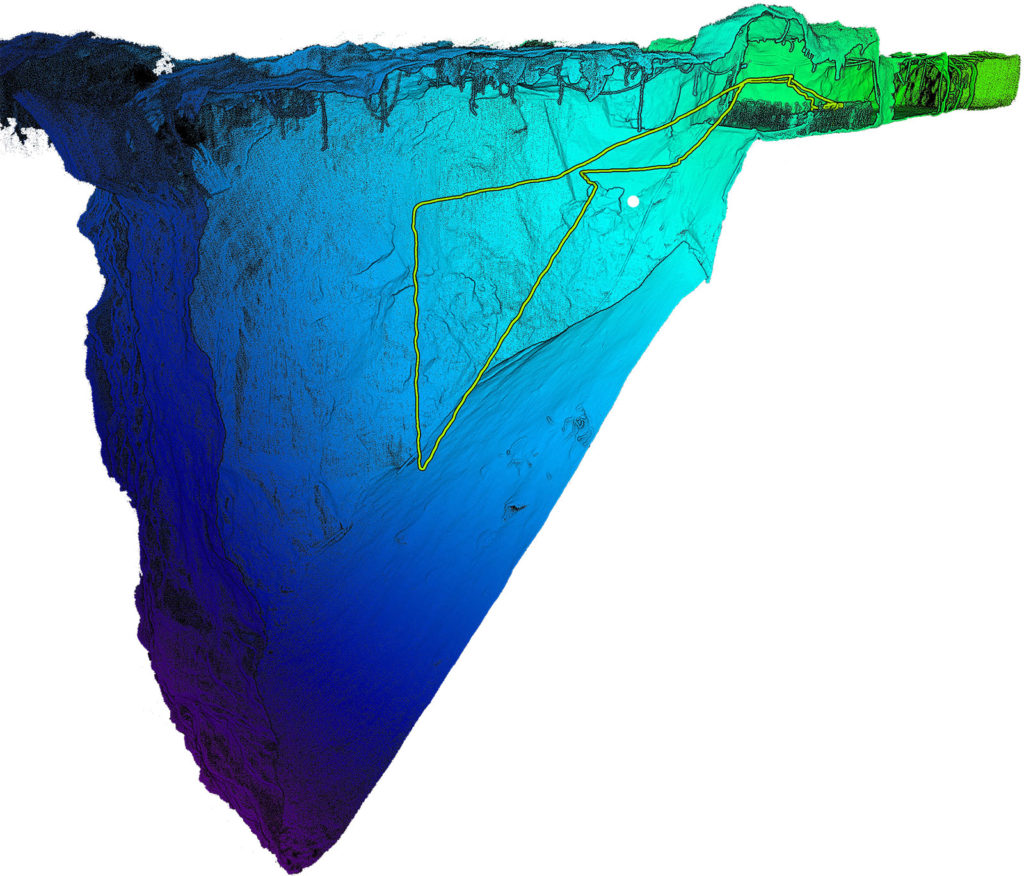
Adding lidar to unmanned aerial vehicles (UAV), also called drones, for collecting geospatial data helps companies understand and analyze the world around them. Applications include aerial and indoor mapping, archaeology, construction, disaster recovery, mining, safety and survey inspections.
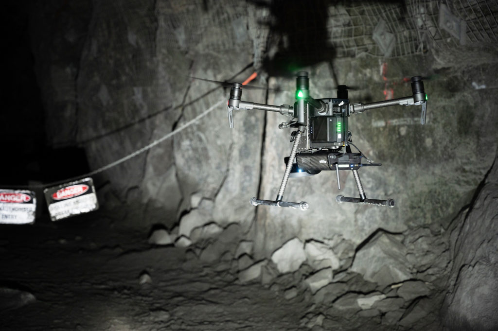
Australia-based Emesent offers a mapping solution called Hovermap, which uses Velodyne’s Puck LITE™ lidar sensor. Hovermap allows drones to map and fly autonomously in challenging GPS-denied environments, such as underground mines, caves and forests.
Lidar has been to the moon and is helping move and measure the world in ways never thought possible. Where are lidar applications headed next? With the vision and ingenuity of a global product development ecosystem, there appears to be no limits.

Velodyne Lidar (Nasdaq: VLDR, VLDRW) ushered in a new era of autonomous technology with the invention of real-time surround view lidar sensors. Velodyne, a global leader in lidar, is known for its broad portfolio of breakthrough lidar technologies. Velodyne’s revolutionary sensor and software solutions provide flexibility, quality and performance to meet the needs of a wide range of industries, including robotics, industrial, intelligent infrastructure, autonomous vehicles and advanced driver assistance systems (ADAS). Through continuous innovation, Velodyne strives to transform lives and communities by advancing safer mobility for all.


